
Mount Semeru Activity Remains Dominated by Eruption Earthquakes
- 30 Apr 2026 09:50 WIB
- Voice of Indonesia
Key Points
- Mount Semeru continues to record frequent eruption earthquakes, indicating ongoing volcanic activity.
- Authorities enforce strict safety zones, urging residents to stay alert for potential hazards such as ash eruptions, lava flows, and lahars.
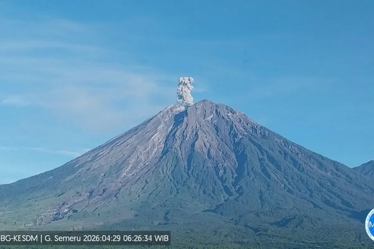
RRI.CO.ID, Lumajang - Volcanic activity at Mount Semeru, East Java, the highest peak on Java Island, continues to be characterized by frequent eruption earthquakes. Situated on the border of Lumajang and Malang regencies in East Java, the 3,676-meter volcano remains under a high state of vigilance.
According to a written report from the Semeru Volcano Observation Post on Thursday morning, April 30, 2026, seismic monitoring between 00.00 and 06.00 local time recorded 15 eruption earthquakes. These tremors exhibited amplitudes ranging from 12 to 22 mm and lasted between 77 and 123 seconds.
"Seismic observations on Thursday from 00.00 to 06.00 local time recorded 15 eruption earthquakes with amplitudes of 12-22 mm and a duration of 77-123 seconds," said observation officer Liswanto, as quoted by Antara.
During the same six-hour window, the volcano also triggered one avalanche earthquake and five gust-related earthquakes. While visual observation was largely obscured by thick fog, officials recorded three distinct eruptions on Thursday, starting with an ash column observed reaching approximately 600 meters above the summit at 00.28 local time.
This was followed by a second eruption at 01.14 local time, though visual confirmation of the column was blocked by the heavy fog. Finally, a third eruption was recorded at 07.30 local time, with specific visual details once again obscured by the prevailing weather conditions.
"For visual observations, the volcano was covered in fog 0-III. Crater smoke was not observed. The weather was cloudy to overcast, with weak winds toward the south and southwest," Liswanto added.
Mount Semeru currently remains at Level III (Alert). Authorities have issued strict recommendations to ensure public safety, including a total ban on activities in the southeastern sector along the Besuk Kobokan area within 13 km of the summit.
Beyond that range, the public is prohibited from entering within 500 meters of the riverbanks along Besuk Kobokan, as there is a high potential for pyroclastic flows and lahars reaching up to 17 km from the peak. Furthermore, a strict 5-km radius from the crater must be maintained to avoid the danger of ejected volcanic rocks.
"The public is prohibited from carrying out activities within a 5 km radius of the crater/summit of Mount Semeru, as it is prone to the danger of glowing rock ejections," Liswanto warned.
Residents are urged to stay vigilant regarding potential hot clouds, lava avalanches, and cold lahars along the river valleys originating from the summit, specifically Besuk Kobokan, Besuk Bang, Besuk Kembar, and Besuk Sat, as well as smaller tributaries that feed into the main river systems. ***
News Recomendation
Loading latest news.....