



Key Points
- Authorities continue enforcing exclusion zones due to the risks of pyroclastic flows and lahars.
- Mount Semeru erupted eight times in 14 hours, with ash plumes reaching up to 900 meters.
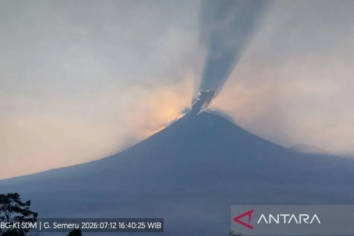
RRI.CO.ID, Jember - Mount Semeru, located on the border of Lumajang and Malang Regencies in East Java, experienced a surge in volcanic activity on Sunday, July 12, 2026, recording eight consecutive eruptions within a 14-hour window, with ash plumes reaching up to 900 meters above its peak.
The spike in activity has prompted authorities to reaffirm strict safety zones around Indonesia's highest volcano on Java Island. While the mountain remains under a Level III (Alert) status, disaster mitigation agencies are closely monitoring potential secondary hazards, including pyroclastic flows and cold lava mudslides (lahar), as rainy weather could destabilize volcanic deposits along river paths.
The eruptive sequence began early Sunday morning at 5.50 a.m. local time, initial volcanic reports indicated, sending a column of white-to-gray ash 600 meters above the crater toward the southeast.
Volcanologists logged subsequent blasts throughout the day at 6.23 a.m., 9.24 a.m., 12.55 p.m., 3.51 p.m., 4.39 p.m., 6.29 p.m., and finally an eighth eruption in the evening.
"The eruption of Semeru Volcano at 7.00 p.m. local time occurred with an observed eruption column height of about 900 meters above the peak, or 4,576 meters above sea level," Mount Semeru Observation Post officer Liswanto confirmed in a written report received in Lumajang on Sunday night, July 12, 2026, as quoted by Antara.
Liswanto noted that during the final 7.00 p.m. blast, the observed ash column shifted northward with a moderate intensity, and seismic activity was still ongoing at the time the report was compiled.
In light of the sustained volcanic tremors, the Volcanology and Geological Mitigation Center (PVMBG) maintains a comprehensive set of safety restrictions for local residents and visitors. Under the current Level III status, all human activity is strictly banned in the southeastern sector along the Besuk Kobokan River channel up to 13 kilometers away from the summit.
Beyond that specific zone, the public is advised against any activities within 500 meters of the riverbeds along Besuk Kobokan. Volcanologists warn that this area faces high risks of being impacted by expanding pyroclastic flows and sweeping lahar streams, which can travel up to 17 kilometers downstream from the peak.
"The public is prohibited from carrying out activities within a five-kilometer radius of the crater/peak of Mount Semeru because it is vulnerable to the danger of flying [incandescent] rocks," Liswanto said.
Furthermore, the observation post urged local communities to remain highly vigilant regarding the potential triggers of pyroclastic surges, lava avalanches, and lahars along all river valleys originating from Semeru Volcano's summit.
"Especially along Besuk Kobokan, Besuk Bang, Besuk Kembar, and Besuk Sat, as well as the potential for lahars in small rivers that are tributaries of Besuk Kobokan," Liswanto concluded. ***
News Recomendation
Loading latest news.....