



Ministry Designates 683,000-Hectare Teon, Nila, and Serua Marine Conservation Areas
- 16 Sep 2026 10:45 WIB
- Voice of Indonesia
RRI.CO.ID, Jakarta - The Ministry of Maritime Affairs and Fisheries (KKP) has officially designated the 683,826.89 hectares of waters surrounding Teon, Nila, and Serua (TNS) Islands in Central Maluku Regency, Maluku Province, as a Conservation Area. This designation aims to expand the protection of marine ecosystems while strengthening the governance of conservation areas in Indonesia.
In a statement received on Monday, September 14, 2026, Director General of Marine Spatial Management at the Ministry of Marine Affairs and Fisheries (KKP), Koswara, said designation is stipulated in the Decree of the Minister of Marine Affairs and Fisheries of the Republic of Indonesia Number 67 of 2026, issued on September 2, 2026. "The designation of this conservation area strengthens Indonesia's contribution toward achieving the target of protecting 30 percent of its marine territory by 2045," he said.
The TNS conservation area is considered vital as it hosts diverse marine ecosystems, ranging from coral reefs and seagrass beds to fish spawning grounds and habitats for hammerhead sharks. Koswara added that the designation also unlocks significant potential to support sustainable fisheries and marine tourism, benefiting local communities without compromising the area's ecological functions.
Regarding management, the KKP Director of Ecosystem Conservation, Firdaus Agung, explained that the TNS Conservation Area would be managed by the local government through a Regional Technical Implementation Unit (UPTD) dedicated to conservation area management. "We hope that this collaboration will lead to effective area management, ensuring that ecological, social, and economic benefits are shared by all," he stated.
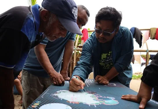
The designation of the TNS Conservation Area was achieved through a lengthy process involving the Ministry of Marine Affairs and Fisheries (KKP), the Maluku Provincial Government, the Central Maluku Regency Government, indigenous and coastal communities, academics, and development partners. A number of stages have been passed, starting from biophysical, social, economic, and cultural surveys, scientific studies, to public consultations as the basis for determining the area.
The Head of the North Maluku Maritime Affairs and Fisheries Service, Erawan Asikin, appreciated the support of all parties involved, including the Nusantara Nature Conservation Foundation (YKAN), which consistently assisted in the process of collecting scientific data, designing zoning, consulting with stakeholders, and strengthening capacity during the process of establishing conservation areas. "This serves as a vital asset for ensuring effective area management in the future," he stated.
Community participation is also an important part of this process, with the Nusantara Nature Conservation Foundation (YKAN) involving the Latupati Agency, kings and state officials, petuanan owners, community and religious leaders, youth and women's groups, fishermen, and coastal communities.
The Nusantara Nature Conservation Foundation (YKAN) Executive Director, Herlina Hartanto, stated that effective marine protection is built through collaboration, science, and community participation. "We are committed to continuing our support for the area's management so that the community can reap the benefits while marine biodiversity is preserved for future generations," she said.
News Recomendation
Loading latest news.....