
East Kalimantan Boosts Protection for Lingkacan Waterfall Site
- 20 Jun 2026 16:28 WIB
- Voice of Indonesia
Key Points
- East Kalimantan authorities are strengthening protection efforts for the Lingkacan Waterfall ecosystem due to its significance as a geological heritage site.
- Lingkacan Waterfall is part of the Sangkulirang-Mangkalihat Geopark and preserves evidence of Earth's geological history dating back millions of years.
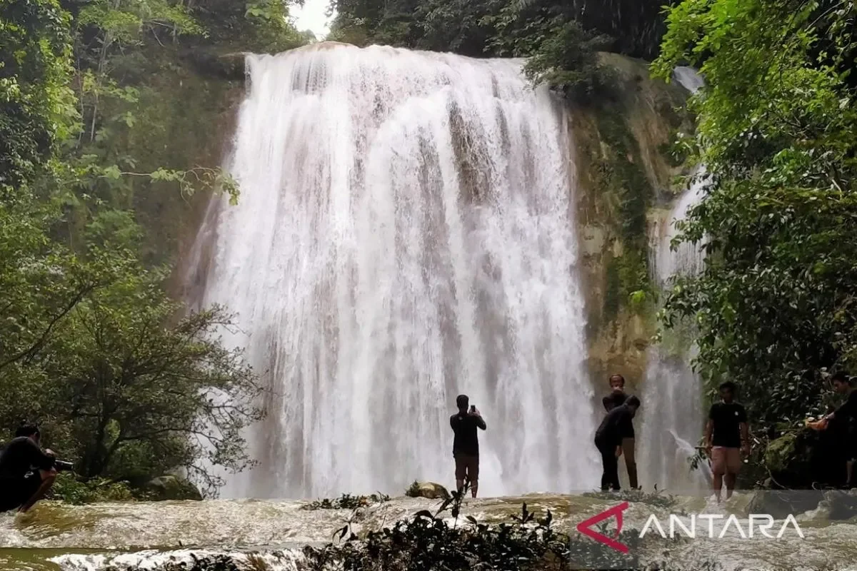
RRI.CO.ID, Samarinda - East Kalimantan officials are scaling up protection of the Lingkacan Waterfall ecosystem, stressing its value as a geological heritage site. This unique site records millions of years of Earth’s history and forms part of the Sangkulirang‑Mangkalihat Geopark.
“Lingkacan Waterfall is not only a natural wonder, but also a geological legacy that records the Earth’s history millions of years ago, and therefore deserves our collective care,” said Acting Head of the East Kalimantan Provincial Forestry Agency in Samarinda on Friday, 19 June 2026.
The site received formal legal recognition in 2024 under Energy and Mineral Resources Minister Decree No. 187.K/GL.1/MEM.G/2024.
The mountain spring ecotourism destination is managed by the Regional Technical Implementation Unit (UPTD) of the Berau Coast Production Forest Management Unit (KPHP) under the provincial forestry agency. Located within the administrative area of Teluk Sumbang village, this destination is integrated into the Sangkulirang‑Mangkalihat Geopark in Berau Regency.
Geologically, the area is dominated by fine siltstone to medium‑grained marl formations that display a natural white hue.
“These exotic rock structures have been shown to contain fossil traces and travertine deposits formed naturally by the dissolution of ancient carbonate minerals,” explained Rusmadi, as quoted by Antara.
Scientists estimate the sedimentary deposits around the waterfall formed between the late Miocene and early Pliocene, roughly five to twelve million years ago. Visually, the landscape features a cascading series of tiers where clear water rushes across the main channel of the Teluk Sumbang River.
Rusmadi said the waterfall’s topography reflects strong geological structures that trend from the northwest to the southeast. Each exposed sedimentary layer along the cliffs, he added, provides evidence of deposition in ancient marine or lacustrine basins.
“The clear water flowing through rock fissures has gradually shaped the valley and recorded the geological evolution of the surrounding environment,” said Rusmadi.
To preserve the site’s natural integrity, authorities require visitors to use provided trash facilities and strictly prohibit removing or damaging rock formations. They warn that such destructive acts would erase important components of the nation’s natural history.
“Tourists should not treat the location solely as a photo opportunity, they must leave only positive traces and not pollute the ecosystem,” urged Rusmadi. ***
News Recomendation
Loading latest news.....