



BRIN Highlights Dieng's Potential for Three Vegetable Harvests a Year
- 14 Jul 2026 19:03 WIB
- Voice of Indonesia
Key Points
- BRIN says Dieng's cool climate and high rainfall can support up to three vegetable harvests annually.
- The agency urges farmers to follow agroecological zoning and slope-based land management to maintain long-term agricultural sustainability.
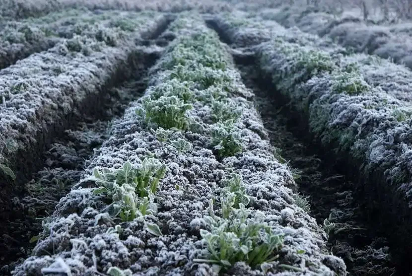
RRI.CO.ID, Bandung - The unique agroclimatic profile of the Dieng Plateau holds the strategic capacity to sustain three continuous crop cycles per year, presenting a major agricultural boon for high-altitude vegetable and plantation farming, according to the National Research and Innovation Agency (BRIN).
Principal Researcher at BRIN’s Climate and Atmosphere Research Center, Aris Pramudia, highlighted the region's ideal microclimate during an online seminar titled The Urgency of Preserving Dieng-Cartenz Snow as an Ecosystem & Environmental Indicator.
Sitting at an elevation of 1,200 to 1,500 meters above sea level (masl), the Dieng Plateau, which spans the Banjarnegara and Wonosobo Regencies in Central Java, benefits from a temperate climate and high rainfall. This contrasts sharply with the Cartenz region in Central Papua, located above 4,000 masl in the Jayawijaya mountains, where the rocky terrain and freezing conditions limit natural vegetation mostly to mosses and ferns.
"Dieng features a monsoonal rainfall pattern, exhibiting a distinct contrast between wet and dry seasons. It receives an average of 3,644 mm of annual rainfall, marked by eight wet months and three dry months," Aris explained, as quoted on BRIN's official website.
He noted that the dry period, where rainfall drops below 50 mm per ten days (dasarian), lasts for only about 11 dasarian blocks. In comparison, Cartenz exhibits a multi-pattern rainfall cycle with over nine wet months, zero traditional dry months, and annual precipitation reaching 2,762 mm.
To map out these agricultural capabilities, BRIN utilized the J.W. Junghuhn climate classification system, which categorizes arable land by elevation and ambient temperature. Under this ecological framework, Dieng sits comfortably within the moderate-to-cool zones. The moderate zone (600–1,500 masl) is highly ideal for crops like tea, strawberries, cabbage, mustard greens, and lettuce, while the cool zone (1,600–2,000 masl) optimally supports specialized highland vegetables, industrial forests, coffee, and cinchona.
"According to the agroclimatic resource classification atlas, regions with average temperatures ranging between 13 to 18.1 degrees Celsius are perfectly matched for highland vegetables, specialized plantations, and native flora," Aris added.
However, the agency stressed that maximizing this agricultural output requires strict adherence to agroecological zoning, particularly concerning slope gradients and soil conservation.
"If the slope gradient exceeds 40 percent, it should not be farmed at all, instead it must be left to natural vegetation for conservation. Slopes between 16 and 40 percent are suitable for plantations," Aris cautioned.
For gentler terrains, Aris recommended agroforestry systems on slopes ranging from 8 to 15 percent, where woody trees are integrated with crops to protect the soil. Flat to gently sloping lands (under 8 percent) can be safely utilized for intense dryland or wetland farming. ***
News Recomendation
Loading latest news.....