



Mount Semeru Erupts Twice on Monday Morning, Sending Ash Up to 1,000 Meters
- 23 Jun 2026 00:00 WIB
- Voice of Indonesia
Key Points
- Mount Semeru erupted twice on June 22, with the strongest blast producing a 1,000‑meter ash plume.
- Authorities maintain Alert Level III and enforce exclusion zones around the volcano and nearby river channels.
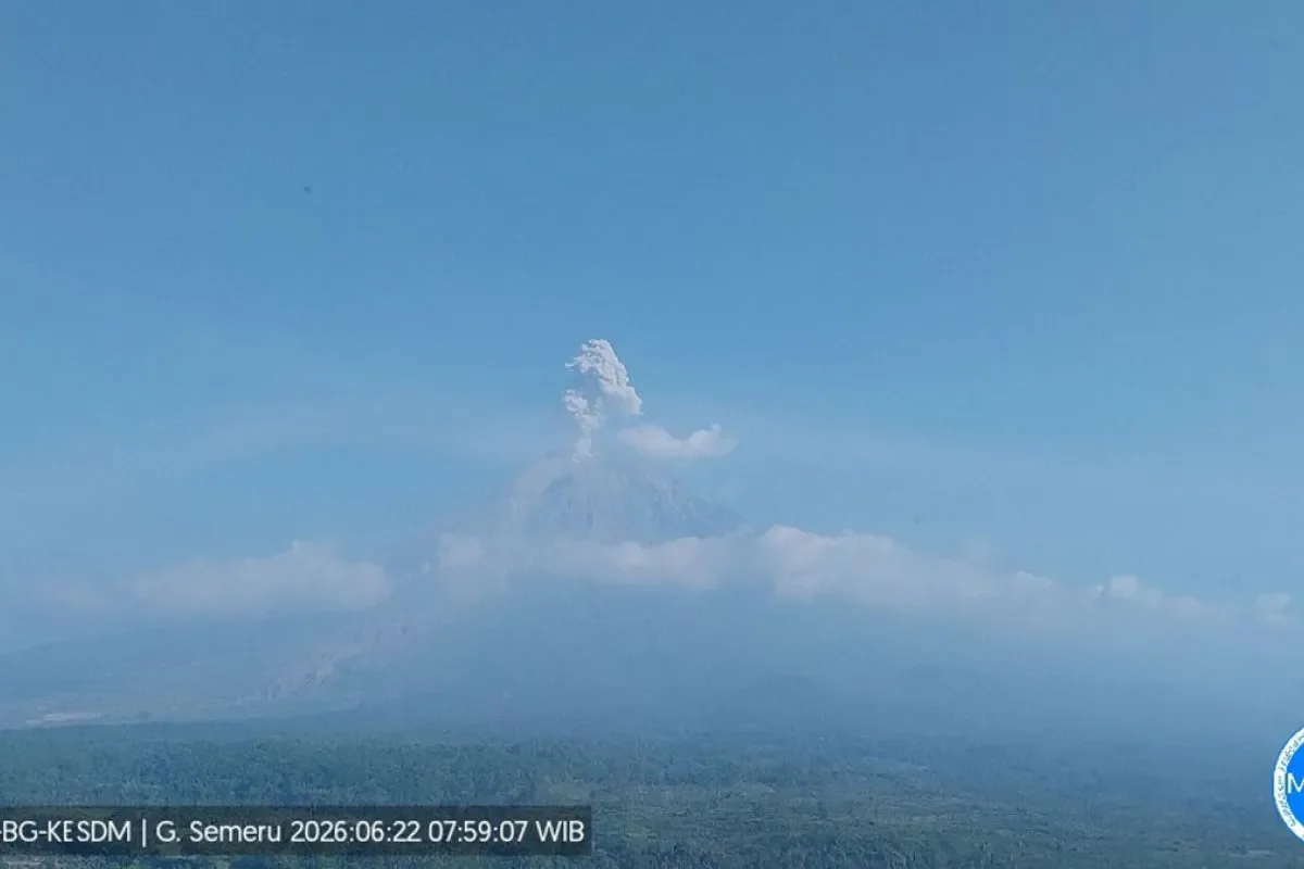
RRI.CO.ID, Lumajang - Mount Semeru, the highest volcano on Java Island, erupted twice in quick succession on Monday morning, June 22, 2026. The larger blast generated a towering ash column that rose 1,000 meters above the summit, prompting geological authorities to impose strict safety exclusions along its active river channels.
Straddling the border of Lumajang and Malang regencies in East Java, the volcano’s most significant activity occurred at 7:57 a.m. local time. The ash plume reached an altitude of approximately 4,676 meters above sea level.
An officer at the Mount Semeru Observation Post, Mukdas Sofian, detailed the eruptions in a written report compiled in Lumajang. “Mount Semeru erupted on Monday, June 22, 2026, at 07:57 local time, with the eruption column observed at around 1,000 meters above the peak, or 4,676 meters above sea level,” he said, as quoted by Antara.
| Baca juga: Mount Semeru Records Eight Eruptions |
The plume exhibited a thick, white-to-gray density drifting westward and southwestward. Seismographs recorded a maximum amplitude of 22 millimeters and a duration of 170 seconds.
This major blast was preceded by a smaller eruption at 6:50 a.m., which vented a 700-meter ash column leaning westward. That event logged the same maximum amplitude of 22 millimeters but lasted 122 seconds.
Mount Semeru remains under Level III (Alert) status. Authorities have issued urgent safety recommendations to protect residents from pyroclastic flows (awan panas) and volcanic mudslides (lahar).
Geological experts have banned all human activity within the southeastern sector along the Besuk Kobokan river channel, extending up to 13 kilometers from the summit.
Beyond that, the public is prohibited from entering zones within 500 meters of riverbanks along the Besuk Kobokan network, which faces elevated risks of pyroclastic surges and mudflows reaching up to 17 kilometers from the crater.
“The public is prohibited from carrying out activities within a five-kilometer radius of the crater or peak of Mount Semeru due to the risk of ejected incandescent rocks,” Mukdas said.
Disaster management officials emphasized vigilance in valleys that serve as primary drainage channels for the summit. Particular focus is on the Besuk Kobokan, Besuk Bang, Besuk Kembar, and Besuk Sat river systems, as well as smaller tributaries, since sudden rainfall could trigger destructive cold lahar flows downstream. ***
News Recomendation
Loading latest news.....