



BRIN Develops Satellite-Based Forest Fire Early Detection System
- 15 Sep 2026 11:11 WIB
- Voice of Indonesia
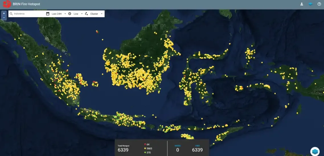
RRI.CO.ID, Jakarta - The National Research and Innovation Agency (BRIN) is developing a satellite-data-based hotspot monitoring system to support the early detection of forest and land fires in Indonesia. Known as hotspot.brin.go.id, this system processes satellite data into hotspot information in approximately 30 minutes, enabling a response to potential fires before they spread to larger areas.
This system is considered important considering the vast area of Indonesia that is difficult to reach manually, especially in remote areas. Early detection allows potential fires to be identified sooner, facilitating on-the-ground intervention before the flames spread widely and become difficult to control.
Technically, the system operates based on the principles of electromagnetic radiation. Every object on the Earth's surface emits thermal radiation corresponding to its temperature; fires, however, generate temperature anomalies significantly higher than the surrounding environment. Fire temperatures are estimated to reach around 1,000 Kelvin, making them readily detectable at a wavelength of approximately 4 micrometers.
The system primarily utilizes data from the VIIRS sensors aboard the Suomi NPP and NOAA-20 satellites. These sensors replace the MODIS instruments on the Terra and Aqua satellites, which had been operational for over two decades but experienced a decline in detection accuracy over time.
Data received by ground stations is transmitted to BRIN’s cloud processing center to be converted into hotspot data. Before being displayed on the dashboard, the data undergoes filtering to minimize false detections caused by industrial activities, coal mining, or volcanic craters. The entire process takes an average of about 30 minutes, depending on data transfer speeds between the ground station and the BRIN cloud.
The number of daily hotspots in Indonesia can reach thousands, especially in the Sumatra and Kalimantan regions, with different patterns in each region. Northern and central Sumatra typically experience an increase in hotspots during the early and middle parts of the year, whereas southern Sumatra sees its peak towards the end of the year.
In Kalimantan, the peak of fire activity typically occurs during the dry season as peatlands dry out. This information is utilized by various agencies—including BNPB, BPBD, police forces in Sumatra and Kalimantan, the National Police (Polri), and BMKG (acting as the data steward).
To enhance accuracy, the system incorporates confidence level indicators and clustering radii to identify locations requiring immediate verification. BRIN continues to refine the system by exploring the use of NOAA-21 satellite data, reinforcing backup ground stations to support the primary station, and improving filtering methods based on historical data.
The system's primary benefit lies not merely in recording fire incidents, but in shortening the time gap between the detection of a hotspot and the on-the-ground response.
News Recomendation
Memuat berita terbaru.....