



BNPB: Unextinguished Land Fires in Six Provinces Down by 62.29 Hectares
- 30 Sep 2026 12:22 WIB
- Voice of Indonesia
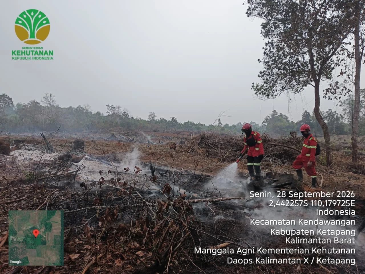
RRI.CO.ID, Jakarta — The National Disaster Management Agency (BNPB) recorded a 62.29-hectare decrease in the area of land still affected by forest and land fires (karhutla) across six priority provinces, bringing the remaining area to 96.07 hectares as of September 28, 2026. Acting Head of BNPB’s Data, Information and Disaster Communication Center, Berton Panjaitan, said the total burned area across the six provinces reached 527.6 hectares. Of that figure, 431.53 hectares had been extinguished through ground and aerial operations.
“Ground operations extinguished 369.03 hectares, while aerial operations covered 62.5 hectares,” he said during a press conference on the latest developments in forest and land fire management at the Coordinating Ministry for Political and Security Affairs on Tuesday, September 29, 2026.
According to data from September 27, 2026, the area of land where fires remained active stood at 158.36 hectares. The largest decline was recorded in Central Kalimantan at 46.70 hectares, followed by South Kalimantan at 17.74 hectares, Jambi at 1.50 hectares, and West Kalimantan at 1 hectare.
However, the Agency recorded an increase in the remaining burned area in South Sumatra by 4.15 hectares and in Riau by 0.5 hectares. Forest and land fire management is being carried out through ground and aerial operations involving BNPB, ministries and agencies, regional governments, the Indonesian Military (TNI), the National Police (Polri), and other relevant stakeholders.
For ground operations, personnel have been deployed across the six priority provinces, with 14,837 personnel in Riau, 7,927 in South Kalimantan, 11,026 in South Sumatra, 4,686 in Central Kalimantan, 5,984 in Jambi, and 14,575 in West Kalimantan. The personnel are carrying out direct firefighting, firebreak construction, wetting, and cooling operations, particularly in peatland areas where embers may remain beneath the surface.
For aerial operations, the Agency has deployed 56 aircraft, consisting of 13 units for patrols and weather modification operations, as well as 43 units for water bombing. BNPB said firefighting efforts in several areas continue to face challenges, including fires on peatlands, limited access and water sources, shifting wind directions, strong winds, and smoke haze that reduces visibility.
To address these challenges, teams are carrying out firebreak construction, peatland wetting and cooling, deploying portable water tanks, optimizing pumps and alternative water sources, and using thermal drones to detect fire hotspots. Water bombing operations are prioritized when visibility conditions meet aviation safety requirements. BNPB is also continuing to coordinate with the Meteorology, Climatology and Geophysical Agency (BMKG) in conducting weather modification operations by monitoring the growth and distribution of potential clouds.
Smoke haze from the fires has also affected air quality, visibility, public health, and educational activities in several areas. The government is monitoring air quality, distributing masks, strengthening health-service preparedness, and implementing distance learning on a situational basis.
BNPB said cross-agency coordination would continue to be strengthened to accelerate firefighting efforts, prevent the fires from spreading, and minimize the impact of smoke haze on communities.
News Recomendation
Memuat berita terbaru.....