



National Hotspots Down by 400 as Ground and Aerial Operations Continue
- 16 Sep 2026 16:33 WIB
- Voice of Indonesia
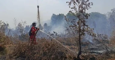
RRI.CO.ID, Jakarta – The number of high-confidence hotspots nationwide fell by 400 to 1,037 as of Tuesday, September 15, 2026, at 9:05 p.m. local time. The Ministry of Forestry, together with a joint task force, continues to strengthen efforts to control forest and land fires through ground and aerial operations.
In a statement issued Wednesday, September 16, 2026, the Ministry of Forestry said that, based on data from its SiPongi system sourced from NASA’s Terra/Aqua, SNPP, and NOAA-20 satellites, the number of hotspots declined in Central Kalimantan from 689 to 266, South Kalimantan from 112 to 72, and West Kalimantan from 203 to 43. Meanwhile, hotspots increased in South Sumatra from 116 to 245, Jambi from nine to 62, and Riau from zero to 15.
The Ministry of Forestry said the increase in hotspots in South Sumatra and Jambi remains a concern in determining priorities for patrols, ground checks, and firefighting operations. With 245 hotspots, South Sumatra now has nearly as many high-confidence hotspots as Central Kalimantan, which recorded 266.
The Ministry of Forestry emphasized that hotspots indicate surface temperature anomalies detected by satellites and do not necessarily represent individual fire incidents. Each indication must still be verified through direct ground checks and monitoring of actual conditions in the field.
Manggala Agni, together with the Indonesian Military (TNI), National Police (Polri), National Disaster Management Agency (BNPB), Meteorology, Climatology, and Geophysical Agency (BMKG), Regional Disaster Management Agency (BPBD), local governments, communities, businesses, and other stakeholders, continues to conduct patrols, ground checks, firefighting, firebreak operations, mopping up, wetting, and cooling operations.
The government has also deployed 53 aerial units to support forest and land fire control efforts in six priority provinces. Of these, 34 aircraft are being used for water-bombing operations, while 19 are assigned to aerial patrols and support for Weather Modification Operations (OMC).
The deployment of aerial assets is based on hotspot developments, ground verification results, fire conditions, and meteorological conditions. OMC remains part of the strategy to control fires and increase land moisture, with implementation adjusted to cloud potential and conditions on the ground.
Aerial support has also been strengthened through Indonesia-Japan cooperation. Defense Minister Sjafrie Sjamsoeddin inspected the Japan Maritime Self-Defense Force (JMSDF) vessel JS Kunisaki and three CH-47 Chinook helicopters in Mempawah, West Kalimantan, on September 15, 2026. The helicopters have been prepared to support accelerated forest and land firefighting operations in the region.
Meanwhile, the BMKG forecast moderate to heavy rainfall in West Kalimantan and Central Kalimantan on September 16, 2026. Atmospheric conditions continue to be monitored, along with local weather changes that may occur rapidly.
The government stressed that developments in forest and land fires cannot be assessed solely based on the number of hotspots, but also require monitoring of actual fire conditions, PM2.5 concentrations, smoke distribution, weather, rainfall, wind direction, and visibility.
The Ministry of Forestry urged people in smoke-affected areas to monitor air quality, reduce outdoor activities if conditions deteriorate, and wear masks when going outside. The public was also reminded not to clear or open land by burning and to immediately report any smoke, fire hotspots, or burning activities.
News Recomendation
Loading latest news.....