
East Kalimantan Enforces Strict Protection Over Lingkacan Waterfall Ecosystem
- 20 Jun 2026 14:49 WIB
- Voice of Indonesia
Key Points
- East Kalimantan has strengthened protection measures for Lingkacan Waterfall, a recognized geological heritage site in the Sangkulirang-Mangkalihat Geopark.
- Visitors are prohibited from littering or damaging rock formations to preserve the site's scientific and ecological value.
RRI.CO.ID, Samarinda - The East Kalimantan Provincial Administration has intensified ecological protection measures around the Lingkacan Waterfall, recognizing the natural site as a critical geological heritage asset that anchors the historical landscape of the Sangkulirang-Mangkalihat Geopark.
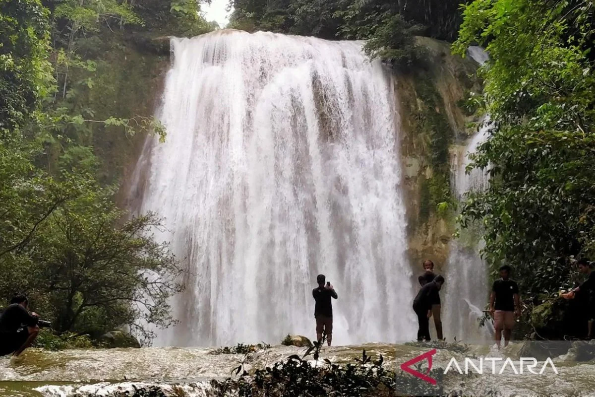
The high-altitude waterfall, managed under the Pantai Berau Technical Implementation Unit of the Forest Management Management Area (UPTD KPHP Pantai Berau) under the East Kalimantan Forestry Agency, is situated within the administrative boundaries of Teluk Sumbang Village, Berau Regency.
The site's structural significance is backed by federal law, having received official recognition under the Decree of the Minister of Energy and Mineral Resources of the Republic of Indonesia Number 187.K/GL.1/MEM.G/2024.
Acting Head of the East Kalimantan Provincial Forestry Agency, Rusmadi, stressed in Samarinda that the site represents much more than a scenic ecotourism destination.
"Lingkacan Waterfall is not just a matter of natural beauty, but it is also a geological heritage that records millions of years of earth's history, making it proof of nature's long journey that we must protect together," Rusmadi said, as quoted by Antara.
The geological matrix defining the waterfall is heavily dominated by white marl rock formations, with grain sizes ranging from fine silt to medium-grained sand.
"The exotic rock structures are proven to contain trace fossils as well as travertine findings naturally produced from the dissolution process of ancient carbonate minerals," Rusmadi revealed.
Scientific models estimate that these sedimentary deposits were formed during the late Miocene to early Pliocene epochs, dating back approximately 5 to 12 million years.
"Visually, the landscape of this waterfall has a tiered [cascade] characteristic that flows swiftly across the main stream of the Teluk Sumbang River," Rusmadi said.
Geologists note that the physical layout of the waterfall is shaped by deep fault structures running from the northwest toward the southeast. Each exposed sedimentary layer flanking the cliffs offers an intact scientific record of pure depositional processes that took place at the bottom of ancient seas or prehistoric lakes.
"The clear water stream that continues to flow from the rock crevices slowly helps create a valley panorama while recording the traces of geological evolution of the surrounding environment," he mentioned.
To prevent human footprint damage from degrading the delicate rock face, the forestry agency has enacted rigid behavioral guidelines for all incoming travelers. Visitors are required to adhere to zero-litter policies and are strictly banned from defacing, breaking, or harvesting any rock samples, as destroying these materials permanently erases invaluable records of the archipelago's natural history.
The provincial administration hopes that by positioning the site as a strictly regulated ecological classroom, travelers will shift their perspective away from simple consumption toward active conservation.
"Tourists should not merely make the location a visual photography object and should always leave behind footprints of kindness without polluting the ecosystem in the slightest," Rusmadi expressed. ***
News Recomendation
Loading latest news.....