



ITB-BRIN Test Underwater Robot for Archaeological Research
- 29 Mei 2026 16:00 WIB
- Voice of Indonesia
Key Points
- An ITB-BRIN research team successfully field-tested an underwater robot.
- Developed as a student capstone project, the remotely operated vehicle (ROV) reached a depth of 20 meters.
- The project aims to map historic shipwrecks during its next phase in October 2026.
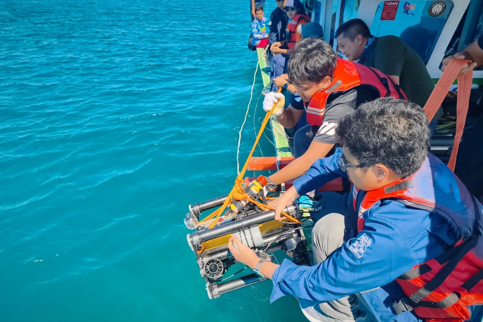
RRI.CO.ID, Jakarta - A research team from the Bandung Institute of Technology (ITB) and the National Research and Innovation Agency (BRIN) has carried out field trials of an underwater robot in the waters of Kepulauan Seribu, Jakarta, on Thursday, May 28, 2026.
The remotely operated vehicle (ROV) is part of the project “DEEP-UNDER ROV: Development of Experimental and Exploratory Photogrammetry for Supporting Underwater Archaeological Studies Using Remotely Operated Vehicle”, funded by ITB’s Directorate of Research and Innovation since 2025 through the Young Lecturer Research Program.
The team, led by Hilton Tnunay from ITB’s School of Electrical Engineering and Informatics, brings together expertise from computer engineering, geomatics, mechanical engineering, and archaeology. The project also involves close collaboration with INSA Strasbourg, France, and HCU Hamburg, Germany, reflecting its international scope.
Development of the ROV was undertaken as a Capstone Project by three undergraduate electrical engineering students--Ibrahim H. Mulyana, Riswandha Mashuri, and Wafi A. Yasin--supported by master’s student Matthew Troy Putra.
The robot is designed to operate at depths of up to 50 meters and to map underwater objects using photogrammetry techniques.
Despite weather limitations and operational challenges, the ROV performed effectively at depths of around 20 meters, capturing clear images of the seabed. Further refinements are planned to enhance its accuracy in underwater mapping.
“The robot we tested in Kepulauan Seribu is the third iteration of research since early 2025. Many lessons could only be learned through direct field testing,” Hilton explained, as quoted on ITB's official website, on Friday, May 29, 2026.
“We limit testing to transitional seasons to avoid extreme weather. Comprehensive lab trials are also crucial to assess motor strength against currents and structural resilience against waves,” team member Gabriella Alodia, from ITB’s Geodesy and Geomatics Engineering, added.
The next round of testing is scheduled for October 2026, with the goal of mapping one of three shipwrecks in Kepulauan Seribu.
“If we can conduct detailed mapping and modeling of underwater archaeological objects, we will not only support tourism but also study the causes of shipwrecks in their historical context. This way, we can predict what led to the sinking of these vessels,” said Harry O. Sofian from BRIN’s Archaeometry Research Center.
The project is expected to serve as the foundation for long-term collaboration between ITB and partner institutions, particularly in advancing underwater observation and mapping technologies that combine scientific innovation with cultural heritage preservation. ***
News Recomendation
Loading latest news.....