



Forestry Ministry Strengthens Forest and Land Fire Control in Six Provinces
- 07 Sep 2026 21:09 WIB
- Voice of Indonesia
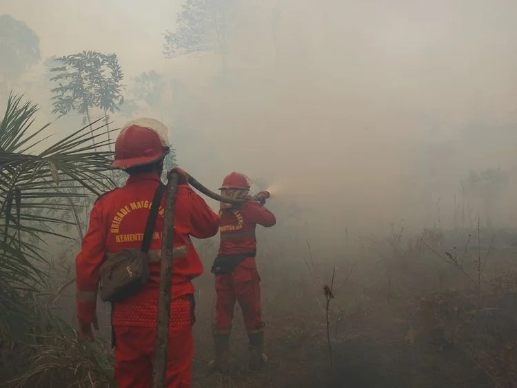
RRI.CO.ID, Jakarta – The Ministry of Forestry, together with a joint team, continues to strengthen efforts to control forest and land fires in six priority provinces following an increase in the number of hotspots in Central Kalimantan and West Kalimantan. Based on data from the Ministry of Forestry’s SiPongi system, sourced from NASA Terra/Aqua, SNPP, and NOAA-20 satellites, a total of 674 high-confidence hotspots were detected nationwide on Sunday, 6 September 2026, at 9.25 p.m. local time. The figure increased from 558 hotspots recorded on Saturday (5 September 2026).
In the six priority provinces, the highest count of high-confidence hotspots was recorded in Central Kalimantan with 243 hotspots, followed by West Kalimantan with 138. South Sumatra recorded 61 hotspots, Jambi 26, South Kalimantan 20, and Riau seven.
The Ministry of Forestry said the situation in South Sumatra showed a positive trend, with the number of hotspots declining by 59, or around 49 percent, in one day. Riau also recorded a decline in hotspots. However, the increase in hotspots in Central Kalimantan and West Kalimantan remains a concern, prompting stronger field operations, particularly patrols, ground checks, firefighting, and efforts to prevent the fires from spreading.
The Ministry of Forestry emphasized that hotspots are indications of surface temperature anomalies detected by satellites and do not necessarily represent individual fire incidents. A single fire incident can be detected as multiple hotspots. Therefore, each indication must be verified through ground checks and monitoring of actual conditions in the field.
Fire control operations are being carried out by the Ministry of Forestry’s Manggala Agni fire brigade in cooperation with the Indonesian Military (TNI), National Police (Polri), National Disaster Management Agency (BNPB), Meteorology, Climatology and Geophysics Agency (BMKG), regional disaster management agencies (BPBD), local governments, communities, businesses, and other relevant stakeholders.
The efforts include patrols, ground checks, direct firefighting, firebreaks, mopping-up operations, cooling, and monitoring of affected areas to prevent fires from recurring.
In addition to ground operations, the government has deployed 53 aerial fleets to support forest and land fire control in the six priority provinces: Riau, Jambi, South Sumatra, South Kalimantan, Central Kalimantan, and West Kalimantan.
Of the total, 19 aircraft are being used for aerial patrols and to support Weather Modification Operations (WMO), while 34 aircraft are being used for water-bombing operations.
The deployment of aircraft is adjusted according to operational needs and developments on the ground. Weather Modification Operations are also being carried out in areas and at times when meteorological conditions are suitable to help increase moisture levels and support fire-control operations.
Meanwhile, the government is also monitoring air quality based on PM2.5 levels. On 6 September, air quality in several areas of Kalimantan and Sumatra remained in the unhealthy to very unhealthy categories. Some areas were even recorded in the hazardous category.
In contrast, most other parts of Indonesia remained in the good to moderate categories.
Based on BMKG monitoring of aviation weather conditions on the night of 6 September, visibility varied across the six priority provinces. Visibility in Pontianak was around two kilometers under hazy conditions, around eight kilometers in Palangka Raya with cloudy conditions, around nine kilometers in Banjarmasin with partly cloudy conditions, 10 kilometers or more in Palembang with cloudy conditions, around seven kilometers in Jambi with cloudy conditions, and around eight kilometers in Pekanbaru with partly cloudy conditions.
The situation in Pontianak remains a concern as BMKG recorded visibility of around two kilometers accompanied by hazy conditions. Meanwhile, visibility in other priority cities was relatively better at the time of observation.
The Ministry of Forestry, together with relevant agencies, continues to monitor hotspots, fire conditions on the ground, air quality, smoke distribution, weather, rainfall, and visibility in an integrated manner to determine operational priorities and resource deployment.
The government also urges the public not to clear or open land by burning. Residents in areas affected by smoke are encouraged to follow official information on air quality, weather, and visibility and adjust their activities if environmental conditions deteriorate.
News Recomendation
Loading latest news.....