



BMKG: Why Heavy Rain Persists During the Dry Season
- 29 Jun 2026 14:13 WIB
- Voice of Indonesia
RRI.CO.ID, Jakarta — The Meteorology, Climatology, and Geophysics Agency (BMKG) reported that heavy to very heavy rain may still occur in several parts of Indonesia from June 26 to July 2, 2026, even as the dry season begins to expand across the country. The conditions are being driven by several active atmospheric phenomena occurring at the same time, which continue to support the formation of rain clouds.
Based on the Agency's analysis for the third 10-day period of June 2026, around 37.6 percent of Indonesia, or approximately 263 Seasonal Zones, had entered the dry season. From June 22 to 24, 2026, maximum air temperatures ranging from 35 to 35.5 degrees Celsius were recorded in West Kalimantan, East Kalimantan, and North Kalimantan. Meanwhile, the highest maximum temperature of 38.6 degrees Celsius was recorded in West Papua.
Despite the heat, heavy to very heavy rainfall was still recorded in a number of regions. The highest daily rainfall was observed in West Kalimantan at 149 millimeters, followed by East Java at 106 millimeters, the Riau Islands at 93 millimeters, North Sumatra at 92 millimeters, West Sumatra at 80 millimeters, Central Papua at 62 millimeters, Jakarta and Aceh at 59 millimeters each, West Nusa Tenggara at 54 millimeters, and Jambi at 53 millimeters.
| Baca juga: Eid 2026 Weather Remains Mostly Stable |
The Agency explained that the situation has been influenced by several atmospheric dynamics occurring simultaneously. The Madden-Julian Oscillation, or MJO, is forecast to pass through Aceh, North Sumatra, Riau, West Sumatra, the southern part of the Riau Islands, eastern Maluku, East Nusa Tenggara, South Papua, as well as the Banda Sea and Arafura Sea waters.
In addition, the Equatorial Rossby wave is expected to be active over northern East Java, southern South Sulawesi, and South Papua. Meanwhile, the Kelvin wave is forecast to be active over West Sumatra, Riau, Jambi, East Nusa Tenggara, southern Maluku, and southern Papua.
The Meteorology, Climatology, and Geophysics Agency also forecasts the formation of a cyclonic circulation over the Pacific Ocean north of Papua. This condition may trigger slowing and convergence of winds, increasing the potential for rain-cloud development around the circulation center and along convergence and confluence zones.
The combination of these atmospheric phenomena, along with still-unstable local atmospheric conditions, is the main reason why the potential for rain remains high in several regions, despite much of Indonesia entering the dry season.
For the June 26–28, 2026 period, the Agency forecasts that weather conditions in Indonesia will be dominated by light to heavy rain. Heavy to very heavy rain, potentially accompanied by lightning and strong winds, is expected to reach alert status in Aceh and Maluku. Strong winds are also expected to affect Banten, West Java, East Java, and West Nusa Tenggara.
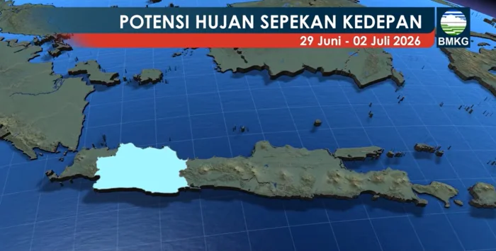
From June 29 to July 2, 2026, light to heavy rain may continue to occur in various regions. Strong winds are forecast in West Java, Maluku, and South Papua.
In response to the situation, the Meteorology, Climatology, and Geophysics Agency urged the public to remain alert to possible extreme weather, maintain adequate fluid intake during the dry season, conserve water, and use protection such as hats, umbrellas, or sunscreen when carrying out outdoor activities. The public is also encouraged to regularly monitor BMKG weather updates and early warnings to anticipate possible hydrometeorological disasters.
News Recomendation
Loading latest news.....