Sutan Sjahrir Air Base Optimizes Territorial Role in Post Disaster Recovery
- 02 Feb 2026 18:48 WIB
- Voice of Indonesia
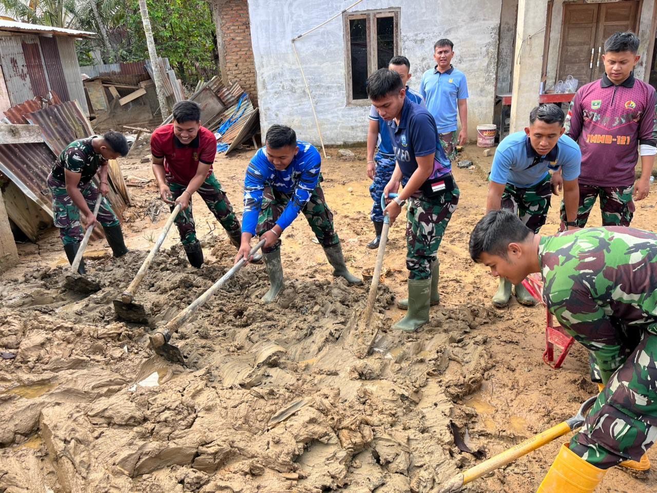
RRI.CO.ID, Padang - Sutan Sjahrir Air Base keeps on optimizing its territorial role to support the recovery of flood-affected areas in the Tabing Banda Gadang Housing Complex, Nanggalo Subdistrict, Padang City, on Monday, 2 February 2026. The continuous assistance is conducted until the environmental conditions recover, as an effort to help the community accelerate the post-disaster normalization process.
The activity was led by Officer of the Aerospace Social Communication Section, Aerospace Potential Staff at Sutan Sjahrir Air Base, Captain Yunadi by involving air base personnel in targeted flood impact management. These efforts include cleaning up affected areas and restructuring residential areas.
In an official statement received by RI VOI on Monday, 2 February 2026, the Commander of Sutan Sjahrir Air Base, Colonel Nav Wahyu Bintoro, stated that the presence of Sutan Sjahrir Air Base personnel in the community is expected to provide moral support to residents. So, they can quickly recover and return to their daily activities.
He stated that this social action is also in line with the Indonesian Air Force's identity: adaptive, professional, and humanistic. Through a sustainable territorial approach, Sutan Sjahrir Air Base affirms its commitment to supporting regional resilience.
Previously, Sutan Sjahrir Air Base provided full support for surveys and aerial photography of areas affected by flash floods and landslides in West Sumatra Province as part of efforts to accelerate post-disaster recovery and strengthen national geospatial data, Monday, 12 January 2026.
This activity was carried out by the Indonesian Air Force's Geospatial Center team, involving personnel from Sutan Sjahrir Air Force Base for security and field assistance, to ensure the entire series of activities ran safely, orderly, and optimally.
Data collection was done by installing and measuring the coordinates of Ground Control Points (GCPs) and Independent Check Points (ICPs) using high-precision geodetic GPS in Padang City, Padang Pariaman Regency, and Agam Regency.
The GCP and ICP data provided a critical foundation for aerial photography using the Indonesian Air Force's Casa C-212/A-2104 aircraft equipped with metric aerial cameras, resulting in high-resolution geospatial maps and imagery.
Besides, this data is crucial for the government as a basis for analyzing damage levels, planning rehabilitation and reconstruction, and mitigating future disaster risks. It also emphasizes the Indonesian Air Force's strategic role in supporting data-driven national development.(Ahmad Faisal)
News Recomendation
Loading latest news.....