
BMKG Lifts Tsunami Warning Following Major Magnitude 7.7 Sulawesi Sea Quake
- 08 Jun 2026 15:43 WIB
- Voice of Indonesia
Key Points
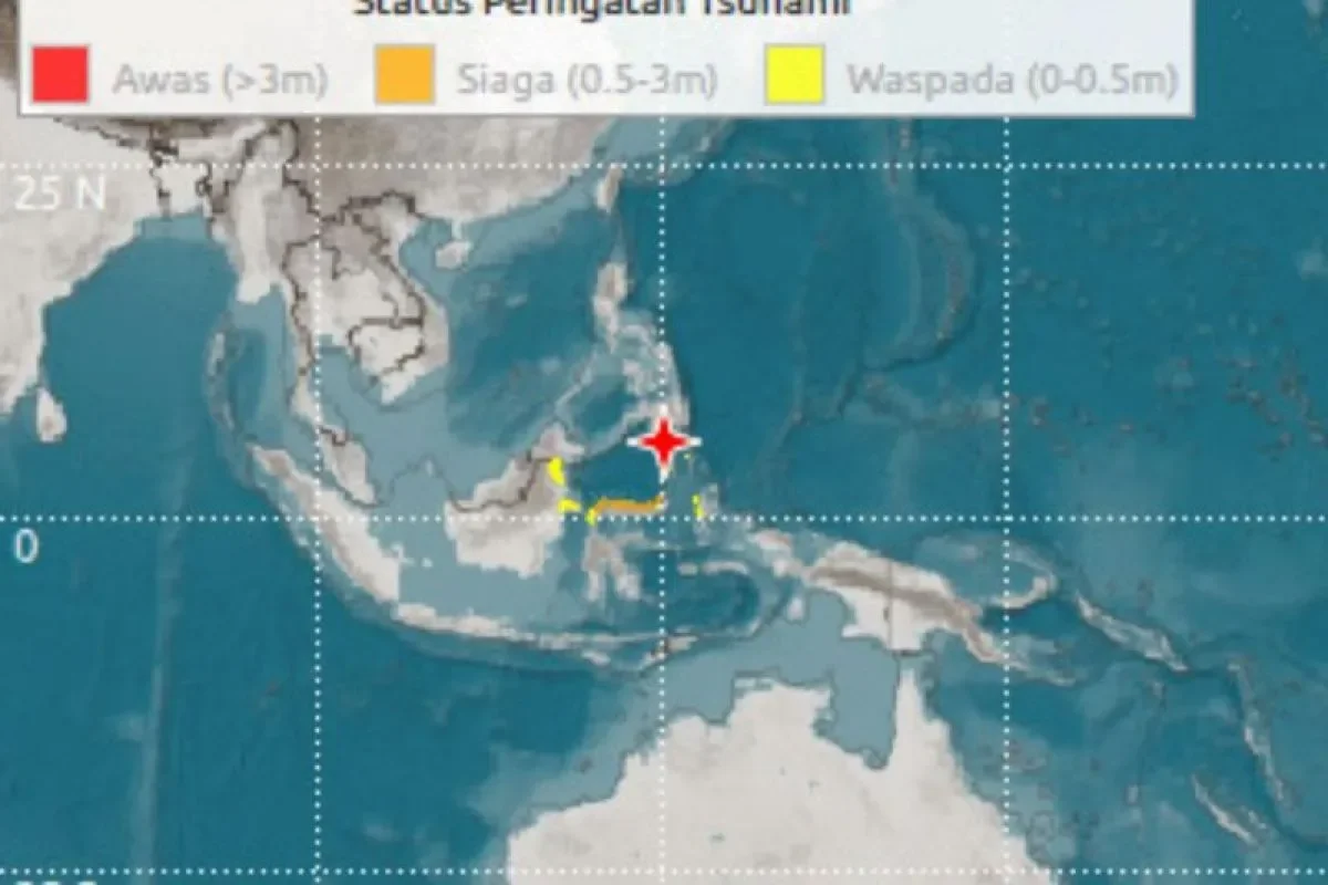
- BMKG officially ended the tsunami warning after sea levels normalized following the magnitude 7.7 Sulawesi Sea earthquake.
- The quake triggered localized tsunami waves in North Sulawesi and North Maluku, with the highest wave reaching 75 centimeters in Sangihe.
RRI.CO.ID, Jakarta - Indonesia’s Meteorology, Climatology, and Geophysics Agency (BMKG) has officially canceled its tsunami warning following a powerful magnitude 7.7 earthquake in the Sulawesi Sea, after coastal sensors confirmed that sea levels had returned to safe parameters.
The decision to lift the coast-wide alert was made at 10.15 a.m. local time, roughly three hours after the massive subduction-zone earthquake rattled the maritime border between North Sulawesi and the southern Philippine island of Mindanao.
"Taking into account the latest conditions regarding observation results in several affected areas, there is no longer any significant or dangerous sea level rise, therefore, the tsunami early warning is declared to have ended," BMKG Chief Teuku Faisal Fathani announced during a press conference in Jakarta on Monday, June 8, 2026, as quoted by Antara.
The formal cancellation is viewed as a crucial operational step for emergency responders on the ground. Fathani noted that the termination allows the joint disaster response teams, comprising Basarnas, local disaster mitigation agencies (BPBD), the military, and the national police, to immediately shift their focus toward structural assessment and consolidation efforts in the hardest-hit zones.
Before the warning was revoked, the BMKG's network of tide gauges recorded localized tsunami waves crossing the archipelago's northern waters.
The highest anomaly was recorded in Palengen, Sangihe, in North Sulawesi, where a wave measuring 75 centimeters struck at 8.20 a.m. local time. Other reporting stations registered wave heights of 45 centimeters in Paleleh, Central Sulawesi; 32 centimeters in Melonguane; 30 centimeters in Tahuna; and 29 centimeters in Bitung. Further east, the waves reached 14 centimeters in Ternate and 9 centimeters in Loloda, North Maluku.
On land, the tremor caused noticeable structural impacts across remote frontier islands. The BMKG reported that the strongest shaking reached an intensity level of VI on the Modified Mercalli Intensity (MMI) scale in Miangas and Melonguane. At this intensity, vibrations are felt by all residents, frequently causing wall plaster to crack and loose masonry to fall.
Shaking at intensity V MMI was reported in Siau and Tagulandang, while residents in Morotai, North Halmahera, and the regional hub of Manado felt an intensity IV MMI tremor, which was strong enough to wake many from their sleep.
Seismologists continue to monitor the unstable fault line. As of 10.00 a.m. local time, the BMKG had logged 20 aftershocks ranging in strength from magnitude 3.9 to a significant 6.7, with at least two of these secondary tremors being clearly felt by coastal populations.
While the immediate maritime threat has passed, authorities caution that mainland hazards remain. The BMKG has urged citizens to stay alert to the danger of compromised buildings and to inspect the structural integrity of their homes before moving back indoors. ***
News Recomendation
Loading latest news.....