
Mount Semeru Erupts Seven Times on Thursday Morning, Plumes Reach 700 Meters
- 04 Jun 2026 12:54 WIB
- Voice of Indonesia
Key Points
- Mount Semeru erupted seven times on Thursday morning, with ash columns rising between 400 and 700 meters above the crater.
- Authorities continue enforcing exclusion zones around the volcano due to risks of pyroclastic flows, lava avalanches, and lahar floods.
RRI.CO.ID, Lumajang - Mount Semeru, located on the border of Lumajang and Malang regencies in East Java, experienced a series of seven consecutive eruptions on Thursday morning. Volcanic monitoring stations recorded varying plume heights stretching from 400 meters to 700 meters above the active peak between 00.34 and 08.00 local time.
The first eruption occurred early in the morning at 00.34 local time, though its visual characteristics could not be observed due to environmental conditions.
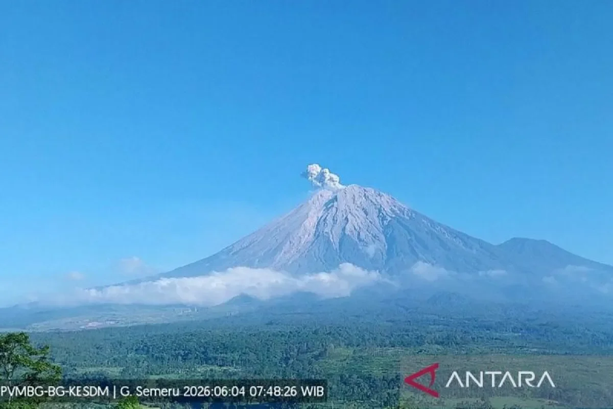
"The seventh eruption occurred at 07.47 local time with the height of the eruption column observed at around 700 meters above the peak or 4,376 meters above sea level (masl)," Mt. Semeru Observation Post Officer Sigit Rian Alfian detailed in a written report received in Lumajang on Thursday, June 4, 2026, as quoted by Antara.
During this seventh eruptive event, the ash column was observed to be white to gray in color, displaying a thick intensity drifting toward the southwest. The eruption was clearly captured on the seismograph with a maximum amplitude of 21 mm and a total duration of 124 seconds.
Further monitoring data compiled during a six-hour observational window from 00.00 to 06.00 local time revealed significant underlying volcanic activity. Regarding eruptive earthquakes, seismometers logged 16 eruption-related earthquakes with amplitudes fluctuating between 12 and 22 mm and durations spanning 51 to 142 seconds.
For gust earthquakes, a total of three gust earthquakes were recorded, maintaining an amplitude range of 3 to 7 mm and lasting between 47 and 49 seconds. Finally, in terms of distant tectonic activity, technicians registered one distant tectonic earthquake with an amplitude of 34 mm, an S-P time interval of 20 seconds, and an overall duration of 78 seconds.
Mount Semeru currently remains under Status Level III (Alert). In response to the elevated volcanic unrest, monitoring authorities have issued strict safety guidelines, heavily prohibiting public and tourist activities across several dangerous sectors.
Authorities have imposed strict exclusion zones around Mount Semeru due to ongoing volcanic hazards. Public access is prohibited within 13 kilometers of the summit along the southeastern Besuk Kobokan sector.
Beyond that area, residents and visitors are also banned from carrying out activities within 500 meters of the riverbanks along Besuk Kobokan because of the risk of pyroclastic flows and lahar floods that could travel as far as 17 kilometers from the crater.
In addition, all activities remain strictly forbidden within a five-kilometer radius of the main crater to prevent exposure to falling rocks and incandescent volcanic material.
The Volcanology and Geological Mitigation Center (PVMBG) urges local communities to remain highly vigilant against potential pyroclastic flows, lava avalanches, and lahar flows along river systems and valleys originating from Mount Semeru's peak. Key pathways demanding close monitoring include Besuk Kobokan, Besuk Bang, Besuk Kembar, and Besuk Sat, as well as smaller streams feeding into the primary Besuk Kobokan catchment. ***
News Recomendation
Loading latest news.....