



Mount Semeru Erupts Seven Times With High Alert
- 06 Apr 2026 11:31 WIB
- Voice of Indonesia
Key Points
- Mount Semeru recorded seven eruptions on Monday morning, April 6, 2026, with ash columns reaching heights between 300 and 1,100 meters.
- The most significant burst occurred at 6:51 a.m. Jakarta time, sending a thick white-to-gray ash column 1,100 meters above the summit toward the south.
- The volcano remains at Level III or Alert, indicating sustained high volcanic activity and potential for further eruptions.
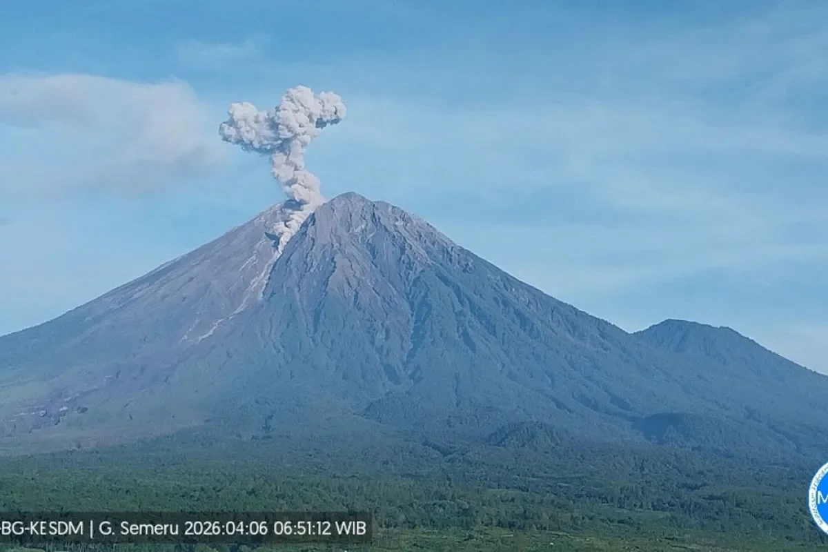
RRI.CO.ID, Lumajang - Mount Semeru unleashed a series of powerful volcanic bursts on Monday morning, April 4, 2026, recording seven distinct eruptions that sent ash columns soaring up to 1,100 meters into the sky. The increased activity at the volcano, situated on the border of Lumajang and Malang regencies in East Java, has prompted authorities to reinforce strict safety zones as the mountain remains under a high-alert status.
The volcanic activity began shortly after midnight at 12:38 a.m. Jakarta time, with an initial eruption reaching 1,000 meters. However, the most significant peak occurred several hours later.
"The eruption with the highest plume was recorded at 6:51 a.m. Jakarta time, with an observed eruption column height of approximately 1,100 meters above the peak," said an officer at the Mount Semeru Observation Post, Liswanto, in a written report received in Lumajang on Monday, April 6, 2026
As reported by Antara, the seventh eruption was recorded at 9:29 a.m. Jakarta time, though visual observations were obscured at that time. Mount Semeru is currently maintained at Level III or Standby, indicating high volcanic activity.
Consequently, the Center for Volcanology and Geological Hazard Mitigation (PVMBG) has issued a firm recommendation for the public to cease all activities within the southeastern sector along Besuk Kobokan. This restriction extends 13 kilometers from the summit.
Safety officials have also warned that beyond that specific distance, the public is prohibited from performing activities within a 500-meter radius of the riverbanks along Besuk Kobokan. This restriction is due to the potential for expanding pyroclastic flows and lahar floods that could reach up to 17 kilometers from the crater.
Furthermore, a strict five-kilometer exclusion zone remains in effect around the summit. "The public is also prohibited from activities within a five-kilometer radius of the crater or peak of Mount Semeru, as it is prone to the danger of incandescent rock ejections," added Liswanto.
Residents are urged to remain vigilant against the ongoing threat of pyroclastic clouds, lava avalanches, and lahars along the river valleys originating from the peak. These risks are particularly high along Besuk Kobokan, Besuk Bang, Besuk Kembar, and Besuk Sat, as well as in smaller tributaries that feed into the main Besuk Kobokan flow. ***
News Recomendation
Loading latest news.....