



Indonesia Records Mixed Hotspot Trends Amid Intensified Fire Control Efforts
- 30 Agt 2026 18:57 WIB
- Voice of Indonesia
Poin Utama
- The Ministry of Forestry maintained full alert status as satellite data revealed a sharp rise in national hotspots.
- Air quality monitoring showed hazardous pollution levels in several priority provinces amid ongoing forest and land fires.
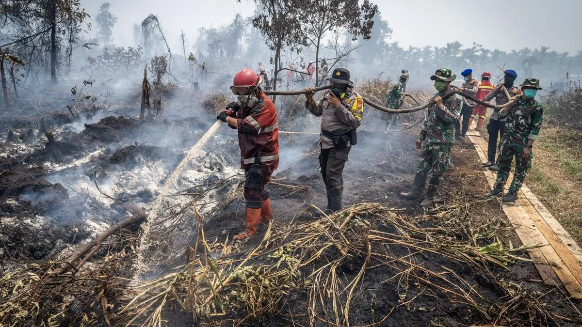
RRI.CO.ID, Jakarta - Indonesia’s forest and land fire situation remains highly dynamic, with recent satellite data showing both declines and increases in hotspots across priority provinces.
While South Kalimantan, South Sumatra, Riau, and Jambi recorded decreases on August 29, 2026, hotspots rose sharply in Central Kalimantan and West Kalimantan, prompting the Ministry of Forestry to maintain full alert status.
According to the Forestry Ministry’s SiPongi wildfire monitoring system, which uses NASA Terra/Aqua, SNPP, and NOAA‑20 satellites, national hotspots reached 20,378 on August 29, up from 18,092 on August 28 and 14,788 on August 27.
Central Kalimantan increased from 7,703 to 8,488 hotspots, while West Kalimantan rose from 3,384 to 6,526. In contrast, South Kalimantan dropped to 867, South Sumatra to 808, Riau to 254, and Jambi to 159.
Rainfall in parts of Riau provided temporary relief, though showers were uneven and many areas remain dry. The Ministry stressed that hotspot fluctuations require continuous vigilance, as declines in some provinces do not eliminate fire risks elsewhere.
Ground operations -- including patrols, fire suppression, mopping up, and peatland cooling -- continue to be reinforced alongside aerial support such as water bombing and weather modification. As of August 29, 112 fire incidents were reported in 11 provinces, with 47 extinguished and 65 still under control efforts.
A Forestry Ministry press release issued on Sunday, August 30, 2026, reported hazardous air quality in parts of Central and West Kalimantan, “very unhealthy” levels in South Kalimantan, and “unhealthy” readings in Riau, Jambi, and South Sumatra. Visibility has also decreased, with Pontianak and Jambi recording less than one kilometer.
The Ministry reiterated that hotspots are satellite‑detected thermal anomalies and not always active fires, requiring ground verification. Communities are urged to avoid land burning and promptly report signs of smoke or fire to the Karhutla Command Post at 021‑5704618, WhatsApp +62 8131‑00‑35000, or email posko.karhutla@kehutanan.go.id. ***
News Recomendation
Memuat berita terbaru.....