



Five Airports Affected by Flores Earthquake, Operations Monitored
- 15 Agt 2026 23:13 WIB
- Voice of Indonesia
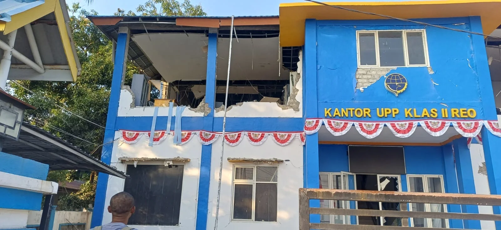
RRI.CO.ID, Jakarta – The Directorate General of Civil Aviation at the Ministry of Transportation reported that five airports across Flores Island, East Nusa Tenggara (NTT), were affected by the earthquake that struck on Saturday, August 15, 2026.
The five airports are Komodo Airport in Labuan Bajo, H. Hasan Aroeboesman Airport in Ende, Umbu Mehang Kunda Airport in Waingapu, Frans Sales Lega Airport in Ruteng, and Soa Airport in Bajawa.
“The Directorate General of Civil Aviation, together with airport operators and air navigation service providers, continues to inspect and monitor facilities, personnel, and flight operations in the affected areas,” the Directorate General said in a holding statement received in Jakarta on Saturday.
Based on information from the Indonesia Tsunami Early Warning System (InaTEWS) of the Meteorology, Climatology, and Geophysical Agency (BMKG), the main earthquake had a magnitude of 7.0 and occurred at 5:58 a.m. Central Indonesia Time (WITA), with the epicenter around 38 kilometers northeast of Mbay, Nagekeo, at a depth of 10 kilometers.
Another earthquake with a magnitude of 6.2 occurred at 6:13 a.m. WITA, with its epicenter at sea around 46 kilometers northeast of Labuan Bajo, at a depth of 10 kilometers.
Reported damage at several airports includes cracks and damage to terminal buildings, administrative buildings, Airport Rescue and Fire Fighting (ARFF) buildings, and other supporting facilities.
At Soa Airport in Bajawa, initial reports indicated moderate damage to the runway, as well as several buildings and supporting facilities, including new cracks found at several points.
Several air navigation service units were also affected, including the Labuan Bajo Sub-Branch Office, Ende Sub-Branch Office, Maumere Unit, Bajawa Unit, and Ruteng Unit. All air navigation service personnel at the affected locations were reported safe.
At several locations, particularly those where tower buildings were damaged, air navigation services are temporarily being provided from locations considered safe.
The Directorate General of Civil Aviation has also prepared a contingency plan to ensure the safety and continuity of air navigation services. “The Directorate General of Civil Aviation places aviation safety as its top priority,” the statement said.
Inspections of airport facilities and infrastructure, as well as air navigation facilities, are continuing. Meanwhile, preparations to deliver assistance to affected communities are being carried out through the Get Airport Ready for Disaster (GARD) scheme.
Air passengers in the affected areas have been urged to remain calm and follow official information from airport operators and airlines regarding flight operations.
The Directorate General of Civil Aviation will continue to monitor developments and coordinate with all relevant parties. Further information on airport conditions, air navigation services, and flight operations will be provided once the latest inspection and assessment results are available.
News Recomendation
Memuat berita terbaru.....