



Earthquake Mapping Identifies Active Faults in East Java
- 09 Sep 2026 18:37 WIB
- Voice of Indonesia
Poin Utama
- BMKG says several active fault lines in East Java require close attention based on the latest earthquake‑source mapping.
- BMKG emphasizes that information on active faults should guide public preparedness and disaster‑risk mitigation, not trigger panic.
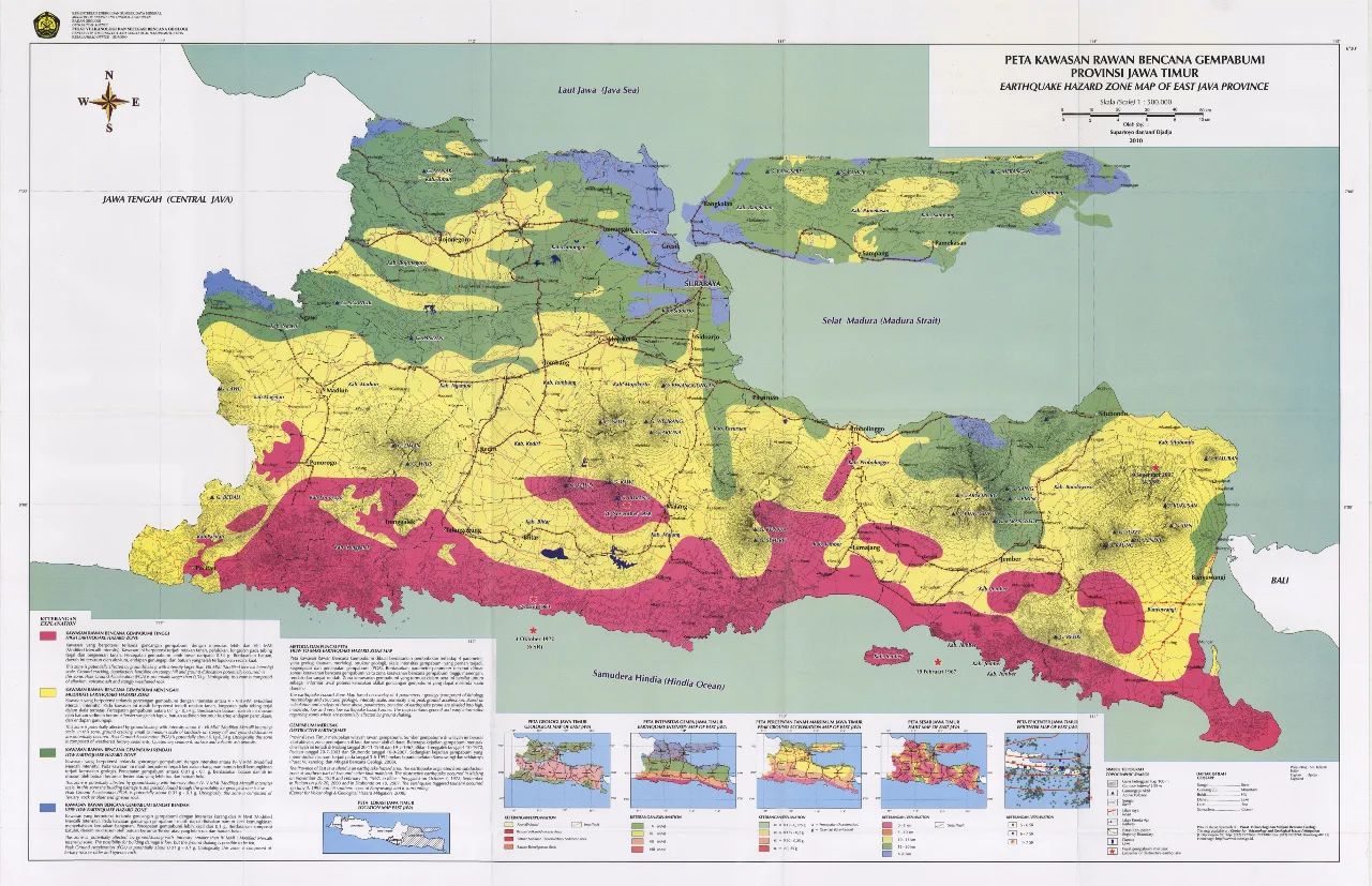
RRI.CO.ID, Jakarta – The Meteorology, Climatology, and Geophysics Agency (BMKG) has identified several active faults in East Java with maximum potential magnitudes reaching M6.7. These fault lines cross the Surabaya, Pasuruan, and Bangkalan areas and form part of Indonesia’s earthquake source and hazard mapping.
The National Earthquake Study Center (PusGen) conducted the mapping and published the results in 2024 as part of efforts to strengthen understanding of earthquake threat sources.
Acting Deputy for Geophysics and Climatology at BMKG, Ardhasena, explained that the map highlights several fault lines in East Java that require attention. One of them is the Surabaya Java Back‑arc Thrust Fault, which passes through the Surabaya area and has a maximum potential magnitude of M6.7.
“The fault lines in East Java appear as follows: one passes through the Surabaya area and is known as the Surabaya Java Back‑arc Thrust Fault,” Ardhasena said in a statement in Jakarta on Wednesday, September 9, 2026.
He emphasized that the data is not intended to predict when an earthquake will occur, but rather to provide a scientific basis for mitigation and development planning.
The statement also underscores that information on active faults is disaster‑related knowledge the public needs to understand, and is not meant to cause panic.
The Bangkalan region is included in the earthquake source mapping because two fault lines have been identified there: the RMKS (Rembang–Madura–Kangean–Sakala)–Baliga Fault and the RMKS–Somorkoneng Fault.
The RMKS–Baliga Fault has a maximum potential magnitude of M6.7, while the RMKS–Somorkoneng Fault has a maximum potential magnitude of M6.5.
Several fault lines in East Java can generate significant earthquakes. However, the presence of these faults does not mean an earthquake of that magnitude will occur soon.
BMKG stresses that information about active faults cannot be used to predict the exact timing of an earthquake. At present, it is impossible to accurately determine when, where, or how strong an earthquake will be.
Therefore, the public is urged not to panic upon learning about active faults in their area. Information on earthquake potential should inform preparedness efforts and reduce risk in the event of a disaster.
Mapping earthquake sources and hazards is crucial for spatial planning and developing infrastructure that accounts for disaster risk. The government can use this information to identify areas requiring special attention in development planning and to enforce earthquake‑resistant building standards. (Misni Parjiati)
News Recomendation
Memuat berita terbaru.....