



Mount Semeru Erupts Three Times, Ash Reaches 1,000 Meters
- 14 Sep 2026 16:58 WIB
- Voice of Indonesia
Poin Utama
- Mount Semeru erupted three times on Monday morning, with the highest ash column reaching 1,000 meters above the summit.
- Authorities maintain Level III alert status and enforce strict exclusion zones around the crater and the Besuk Kobokan river valley.
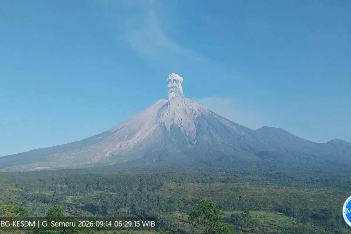
RRI.CO.ID, Lumajang - Mount Semeru in East Java erupted three times on Monday morning, September 14, 2026, sending thick columns of volcanic ash up to 1,000 meters above its peak.
The first eruption occurred at 04:20 a.m. local time, producing a 500‑meter ash column drifting northwest. A second eruption followed at 05:53 a.m., raising ash 800 meters toward the north and northwest.
The highest blast was recorded at 06:28 a.m., generating a dark grey ash plume 1,000 meters above the summit (4,676 meters above sea level) drifting eastward. Seismograph readings logged maximum amplitudes between 21 mm and 23 mm, with durations of up to 140 seconds.
Mount Semeru remains under Level III (Alert) status. Volcanologists have enforced strict safety perimeters, restricting all outdoor activities within 5 kilometers of the crater and prohibiting access along the Besuk Kobokan river valley up to 13 kilometers from the summit.
Volcanological officers detailed technical observations of the morning eruptions and outlined mandatory safety exclusions for surrounding communities.
Mount Semeru Observation Post Officer Sigit Rian Alfian documented the seismic data following the initial eruption.
“The ash column was observed ranging from white to grey with thick intensity drifting toward the northwest. The eruption was recorded on the seismograph with a maximum amplitude of 21 mm and a duration of 128 seconds,” Sigit stated in a written report received in Lumajang on Monday, September 14, 2026, as quoted by Antara.
He later described the parameters of the third and highest eruption.
“The ash column was observed in grey with thick intensity drifting to the east. That eruption was recorded on the seismograph with a maximum amplitude of 23 mm and a duration of 140 seconds,” he noted regarding the 06:28 a.m. blast.
Addressing public safety under the active Level III status, Sigit emphasized exclusion zones along riverways vulnerable to pyroclastic flows and lahars.
“Outside that distance, the public is strictly prohibited from conducting activities within 500 meters of the riverbanks along Besuk Kobokan, as it may be affected by expanding pyroclastic flows and lahar flows up to 17 kilometers from the peak. People must not carry out activities within a 5‑kilometer radius of the crater or summit of Mount Semeru due to the hazard of incandescent rock projectiles,” Sigit explained.
He also warned residents near river networks to remain vigilant against secondary cold lava flows during adverse weather.
“We urge the public to remain vigilant against the potential for hot clouds, lava avalanches, and lahars along river flows or valleys originating at the peak of Mount Semeru, especially along Besuk Kobokan, Besuk Bang, Besuk Kembar, and Besuk Sat, as well as potential lahars on smaller rivers that are tributaries of Besuk Kobokan,” he added. ***
News Recomendation
Memuat berita terbaru.....