



Mount Semeru Erupts, Sends 700-Meter Ash Column into Sky
- 30 Jul 2026 12:17 WIB
- Voice of Indonesia
Poin Utama
- Mount Semeru erupted on Thursday morning, sending a 700-meter ash column above the summit while remaining at Alert Level III.
- Authorities urged residents to stay out of designated danger zones due to ongoing risks of pyroclastic flows, lava avalanches, and lahars.
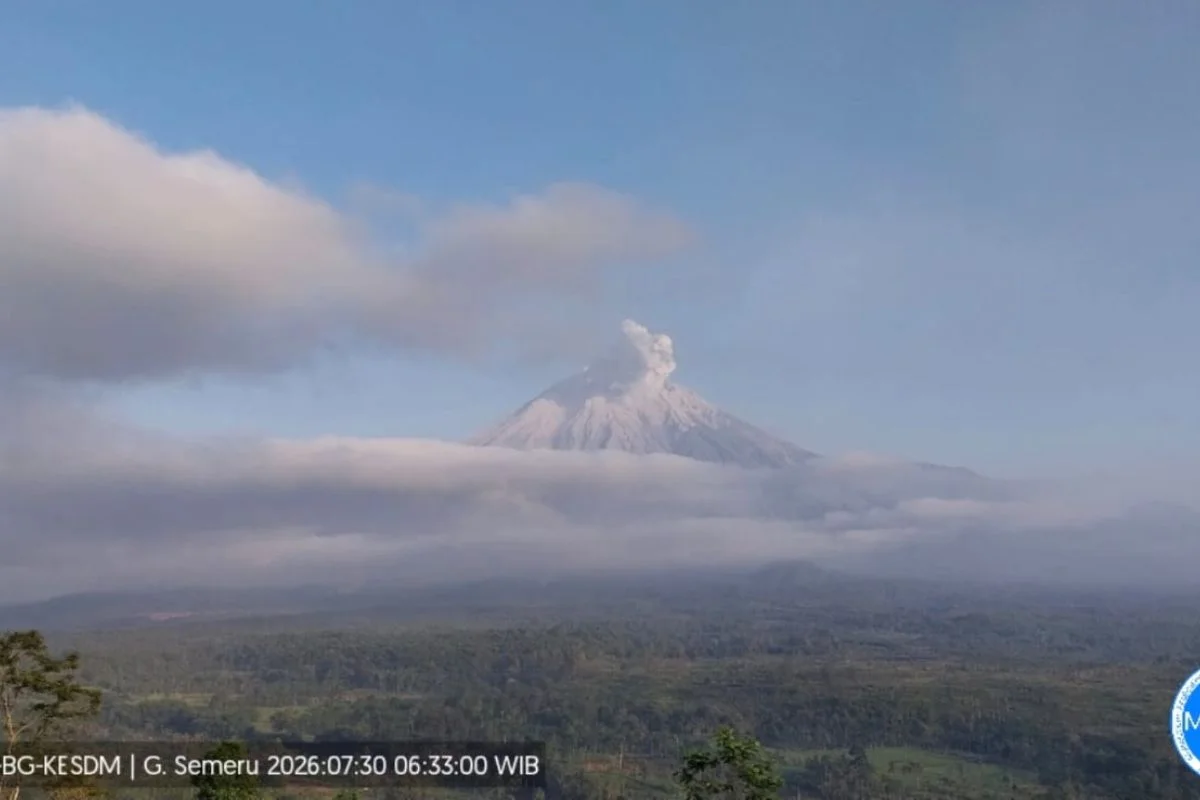
RRI.CO.ID, Lumajang - Mount Semeru, located on the border of Lumajang and Malang Regencies in East Java, erupted on Thursday morning, July 30, 2026, spewing a thick ash column roughly 700 meters above its peak.
The eruption occurred at 06.31 a.m. local time, producing a thick white-to-gray ash plume drifting toward the northeast. According to seismographic readings from the Mount Semeru Observation Post, the eruption registered a maximum amplitude of 22 mm with a duration of 130 seconds. During the six-hour observation window between midnight and 06.00 a.m. local time, authorities recorded 24 eruption earthquakes, three rockfall earthquakes, and two distant tectonic earthquakes.
The volcano currently remains at Status Level III (Alert). Volcanology officials instructed residents to avoid all activities within a 13-kilometer radius from the summit along the Besuk Kobokan sector, as well as maintaining a 500-meter distance from riverbanks due to pyroclastic flow and lahar risks extending up to 17 kilometers. A strict 5-kilometer no-entry zone from the crater remains in effect due to the hazard of incandescent rock projectiles.
Volcanology authorities urged the local population to maintain high vigilance regarding secondary hazards, particularly cold lava flows along surrounding river basins.
An officer at the Mount Semeru Observation Post, Sigit Rian Alfian, detailed the seismic findings and safety protocols in an official report received in Lumajang on Thursday. "An eruption of Mount Semeru occurred on Thursday, July 30, 2026, at 06.31 local time with an observed eruption column height of approximately 700 meters above the summit," Sigit stated.
Sigit stressed the importance of adhering to safety zones and monitoring river basins originating from the summit.
"The public is prohibited from conducting activities within a five-kilometer radius from the crater/summit of Mount Semeru due to the danger of incandescent rock throws, we advise the community to remain alert to the potential for pyroclastic flows, lava avalanches, and lahars along river channels and valleys originating at the peak of Mount Semeru, particularly along Besuk Kobokan, Besuk Bang, Besuk Kembar, and Besuk Sat," Sigit emphasized. ***
News Recomendation
Memuat berita terbaru.....